This article is supplemental to A Legend Landscape.
51º24’40.76N 1º51’20.09W
After the Total Station battery failed on the first day, we proceeded to set up a 300m datum North to South and used basic triangulation to set out grids covering 300m2 between Swallowhead Spring and West Kennet long barrow. Eastings and Northings were worked out later and plotted on Surfer as a surface diagram. Readings were taken at intervals of three metres.
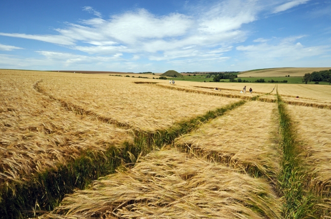
A second site of one hectare was set out in an adjacent field to the east, at a location where identical crop circles appeared in 2011 and 2014. A plan of the geometry of those circles can be seen below.
Both sites were surveyed over five days during the first two weeks of January using a Bartington MS2 magnetic susceptibility field coil and meter.

A ghostly ‘shade’ “like a river, [forming] curves and eddies” follows the ‘Mary’ line discovered by Hamish Miller, as described in Broadhurst & Miller’s The Sun and the Serpent (1989). The line runs through the site of a Bronze Age bell barrow, since lost to the plough. In the next field, a similar impression of a crop circle that recurred at that spot in 2011 and 2014.
The Crop Circle
The ‘crop circle’ consisted of a flattened disk with concentric bands enclosed within a thin ring. Encoded into the sequential radii of the rings were polygons of 4, 5, 6, 7 and 6 sides consecutively. If this sequence had continued, with 7 going to 8 instead of 6, carrying on to 9, 10, 11 and so on, the gaps between the rings would have narrowed to the infinitesimal, eventually forming an infinite-sided polygon – a circle. The ratio between the radius of this implied circle and the innermost ring, give or take a tenth of an inch, amounted to the Golden Ratio, or phi, that expression of the divine in art, mathematics and nature. That this geometrical schema is partially visible in the survey suggests a relationship between effects on the surface and the subsurface.
As part of the public engagement aspect of this project I invite anyone who wants to come on a wander around these sites and the wider landscape (Windmill Hill, Avebury, the Sanctuary) to join me at the Waggon & Horses pub, Beckhampton (a mile west of Silbury Hill) on Sunday 1 Feb at 11am, setting off around noon.
Plans are also afoot for me to talk about the project, and the concept of mythoarchaeology in particular, at 44AD, a contemporary art space in Bath. I’ll post details when I have them.


Pingback: A Legend Landscape | Public Archaeology 2015